

8th April 2026
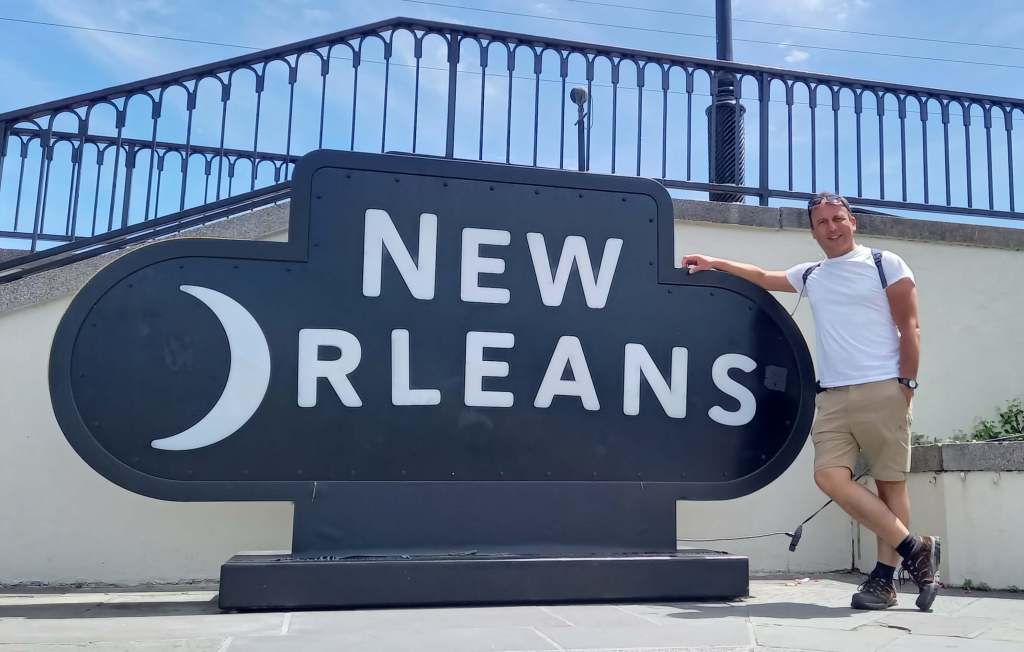
Greetings from New Orleans! Out of all the amazing places I’m visiting on this trip, this one feels the coolest and most exciting to me! I had watched Disney’s “The Princess and the Frog” just before I began this trip, as I love watching a good Disney film set in the places I plan to visit. I love the stylised presentation of these places, and always try to download the soundtracks to my playlist to get me in the mood. This soundtrack is filled with great songs and great jazz, just like the Crescent City itself!
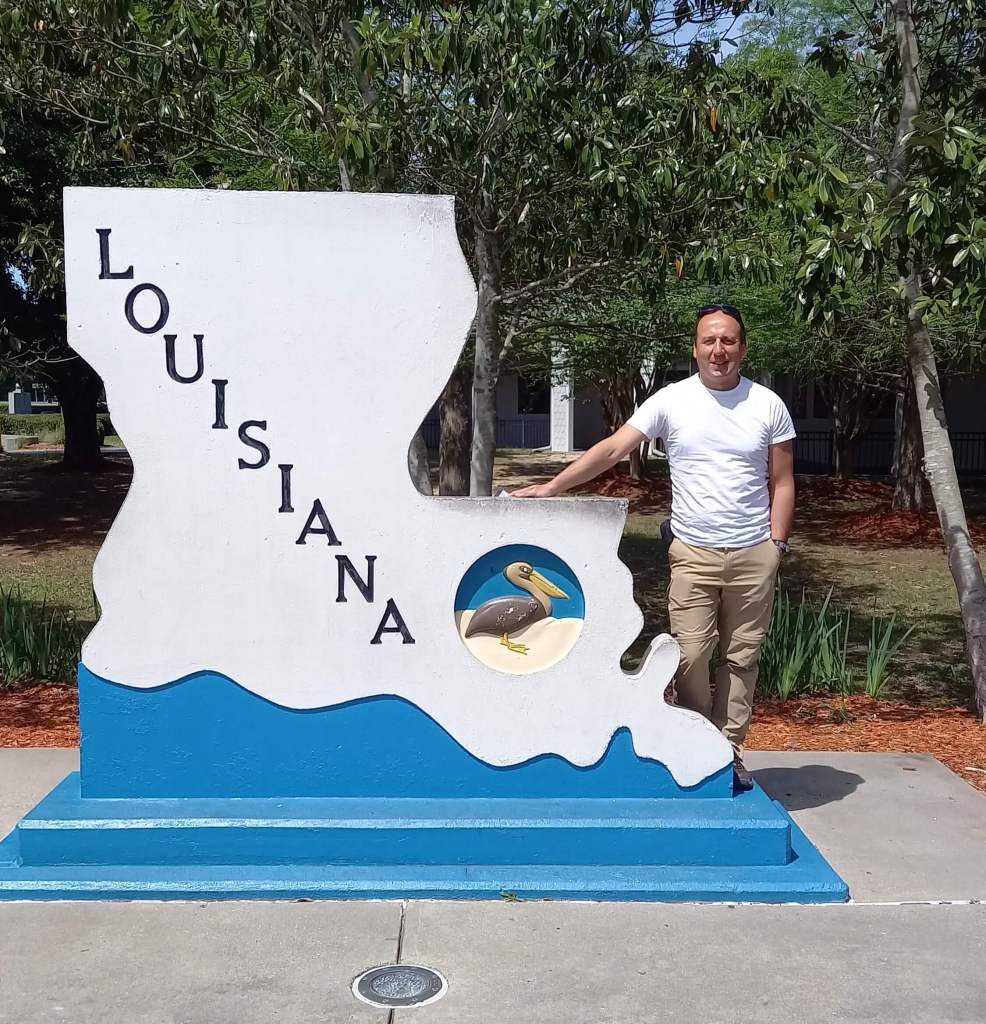
After leaving my very comfy casino hotel accommodation in Biloxi on the Mississippi Gulf Coast, I headed over yet another state border, this time into Louisiana. This was my seventh state thus far in only one week of travelling! It felt immediately different – flat, watery, and notably poorer and shabbier, which is quite something considering I was coming from Alabama and Mississippi, notably “up there” in lists of America’s poorest states. And many place names and street signs were also of French origin, testimony of course to the state’s history.
Yes sir, after the famous Louisiana Purchase of 1803 in which the Americans bought the vast swathe of land west of pretty much the whole length of the Mississippi from the French, the size of the United States doubled overnight! Napoleon himself had decided to make the deal to raise $15m at the time in France’s war against the British, and to also prevent the land ending up in the latter’s hands – the Americans had thus bought nearly a million square miles of land at the bargain price of just 4 cents per acre (72 cents per acre in today’s money)! Subsequently, this bottom part of the purchase continued to be named Louisiana, originally after French King Louis XIV, while the rest of the territory became ripe for 19th century US western expansion just as the country was becoming great and powerful in its own right.
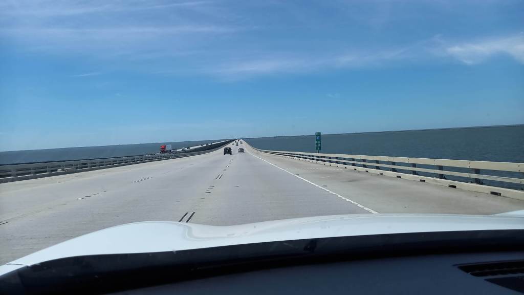
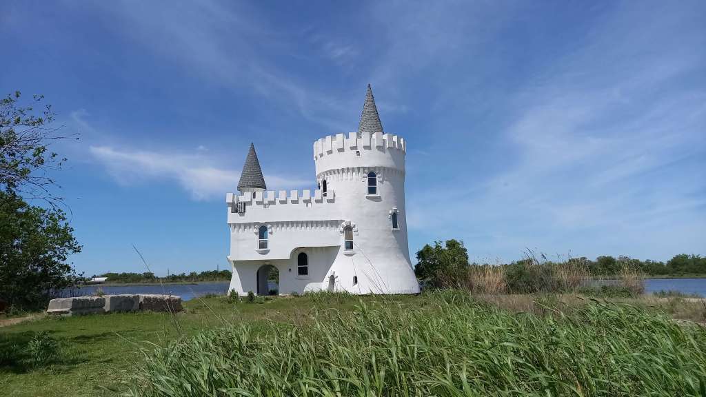
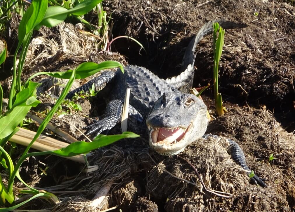
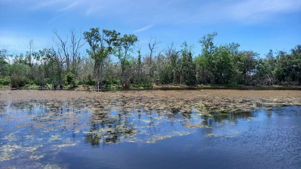
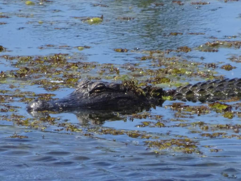
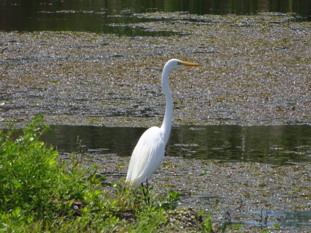
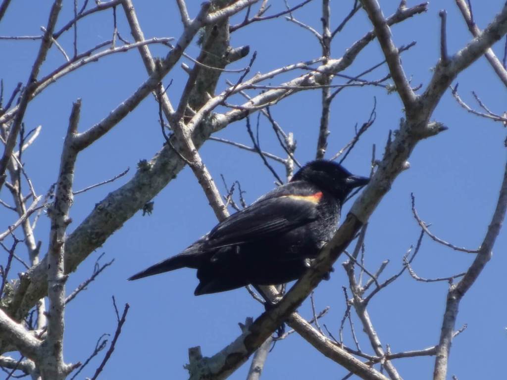
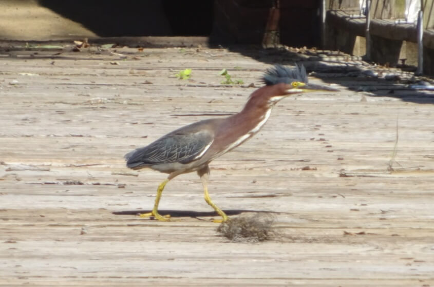
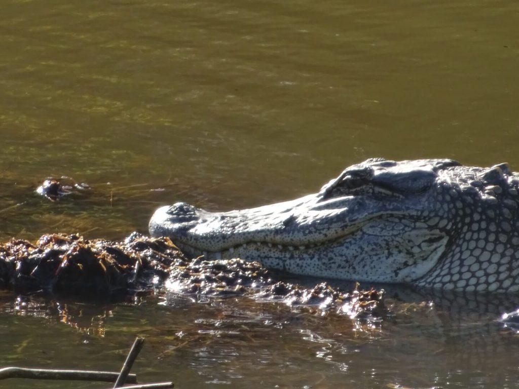
After driving over the spectacular I-10 Twin Span Bridge over Louisiana’s Lake Pontchartrain, I stopped off first at the Bayou Sauvage Urban National Wildlife Refuge for a couple of short boardwalks in my first experience of a southern “bayou”, the name given to the swampy marshlands around these parts of the Mississippi Delta. I spotted two alligators to welcome me to the state! And also several birds. Also viewed an interesting building called the Fisherman’s Castle at Irish Bayou.
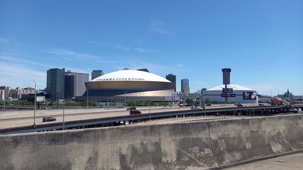
I then drove through New Orleans, past its famous Superdrome (it was absolutely huge!), and over the spectacular Mississippi River Bridge over the Mississippi River which runs through town. I was actually heading past New Orleans to start with, towards a tiny and aptly-named settlement 75 miles south called Venice, population around 260, surrounded by the numerous distributaries, river islands and marshlands at this very tip of the Mississippi Delta as it empties out at its furthest point into the Gulf of Mexico/America. It is also Louisiana’s southernmost drivable point, and while there really wasn’t that much to see at the end, the journey was just fascinating.
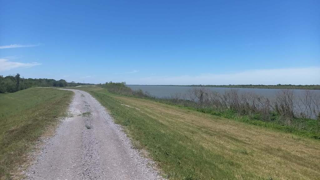
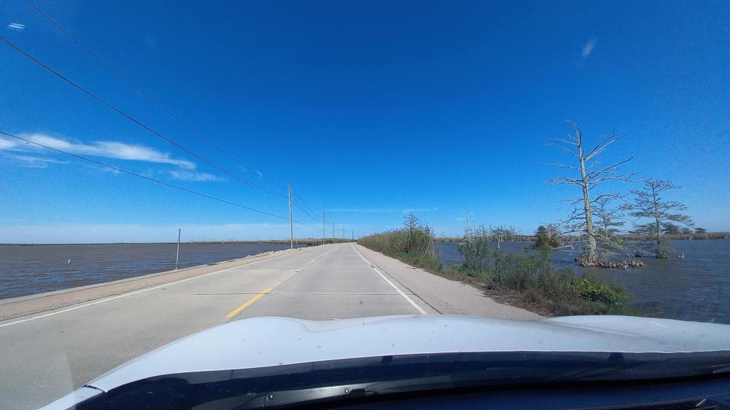
Driving there felt like driving a shabbier, hickier version of the Florida Keys which I’d done three years earlier. The highway crossed over a few bridges and eventually became surrounded by water on pretty much all sides. It followed the right bank of America’s mightiest river, beneath its levee, and the lyrics “drove my Chevy to the levee” were in my head throughout!
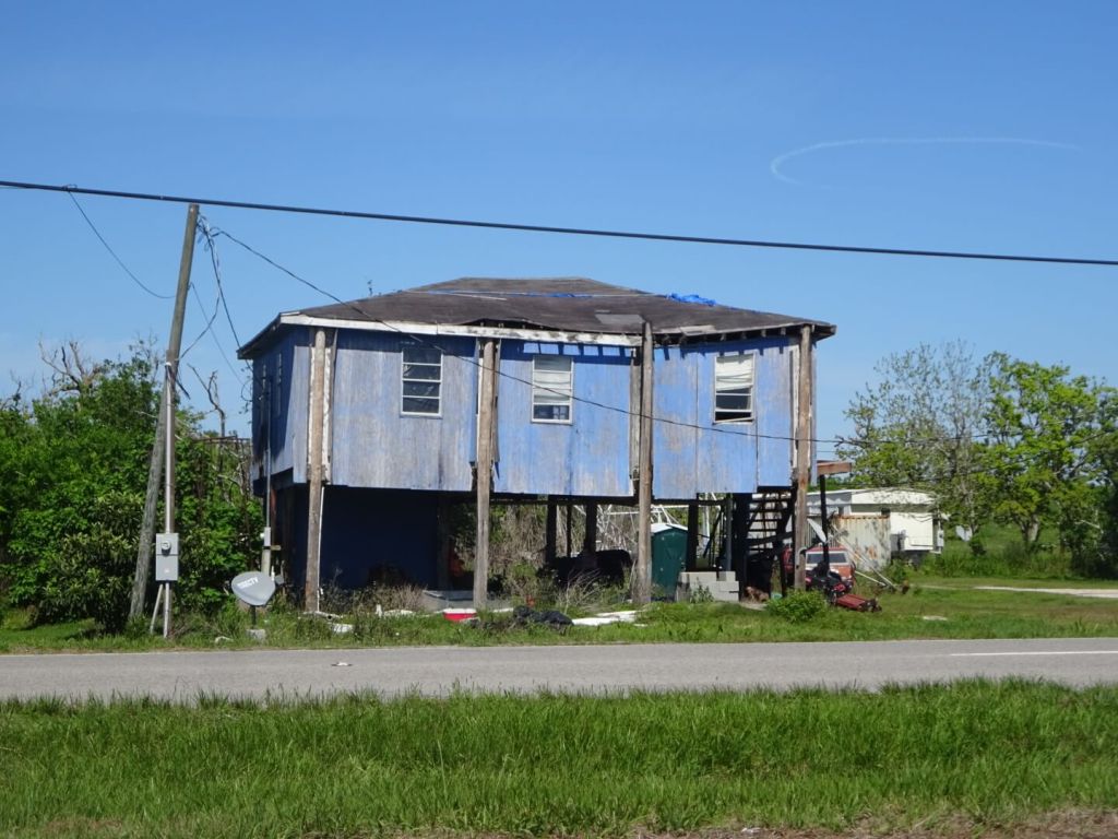
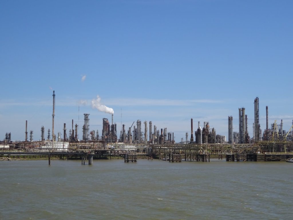
The houses were mostly poor, often just shacks in various states of disrepair, and many were built on stilts up to around eight metres high I’d say. I imagined that would be for protection against storm surges and hurricanes which much must be fairly frequent around here, and of course greater precautions will have been made since the terrible ordeal of Hurricane Katrina in these parts back in 2005. The road was pretty poor too, and really quite bumpy in places. It felt like I was driving towards the end of the world. Although the river wasn’t visible for much of the journey due to the levee, you could see it was there every now and then with glimpses of the tops of huge ships either docked or travelling up and down the vast waterway in various places. These were mostly oil tankers, and I passed by several huge oil refineries on the way.
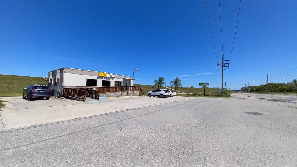
I stopped off for lunch at the most isolated Subway branch I’d ever seen, in the not very attractively-named suburb of Potash of the equally unattractively-named settlement of Port Sulphur. The fast food joint felt a lovely little bastion of modernity in a tiny hut surrounded by shabbiness, and I enjoyed my lunch as a picnic on the levee overlooking the mighty Mississippi below, birds flying overhead, including several birds of prey.
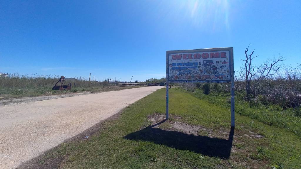
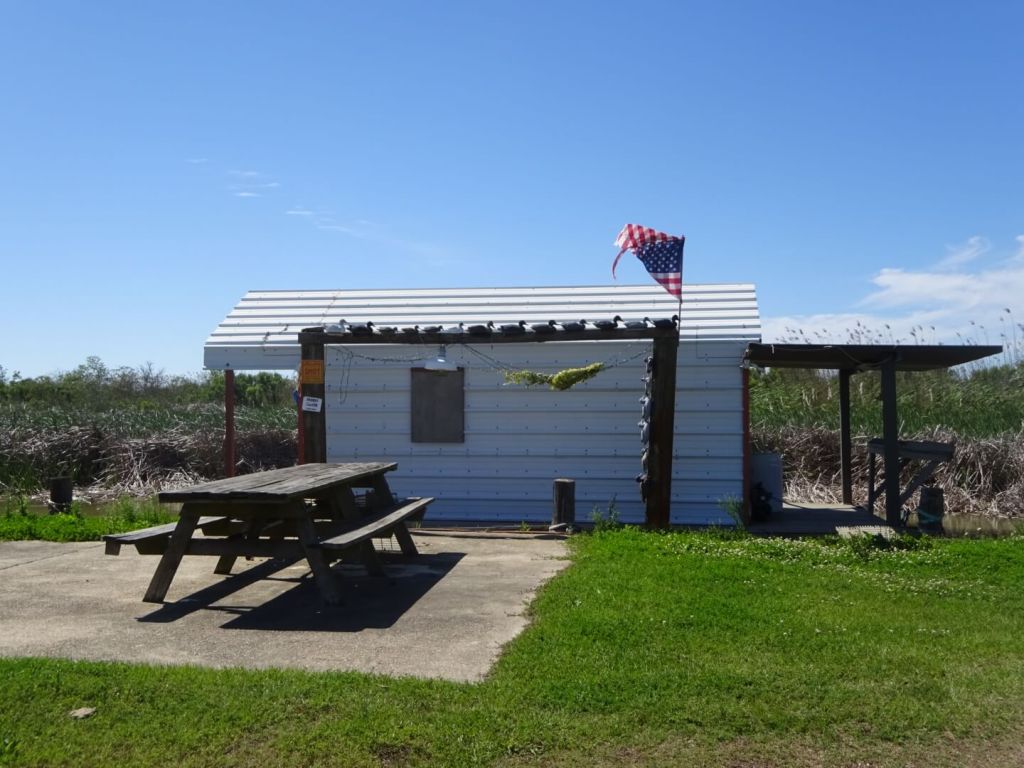
Eventually I arrived at the southern tip just past the tiny settlement of Venice, which was rather underwhelming to say the least, but very satisfying – it was more the journey than the end-point itself. There was a sign there marking “The Southernmost Point in Louisiana”, but it was heavily graffitied, filled with stickers, and even had a fair few bullet holes. Just before arriving, there was a short bit of flooded road to drive through, which coupled with the tiny shack just beyond the sign with a foreboding sign saying “No Trespassing. Violators will be SHOT, survivors will be shot again”, and another saying “Paddle faster, I hear banjos” (!), encouraged me not to hang around too long. I really wasn’t sure whether these signs were serious or tongue-in-cheek, but considering the utmost isolation of the place and lack of any other vehicles, I didn’t want to be that one occasional nosey tourist who disturbed the peace of the shack’s resident just that little bit too much to send him over the edge. After a few quick photos, I did a three-point turn, and headed back into mainland USA again.
Because of the remoteness and hillbilly nature of the place, which I’d seen in some of the facial features of some of the locals, and its surprisingly little-visited nature which I thought would have been more popular given its interesting geographical significance, I found driving the Mississippi Delta to have been a fascinating and rather bizarre journey. Admittedly I had at times images from “Deliverance” flashing through my mind every now and then, but I was glad I’d had pretty much the whole of this adventure to myself.
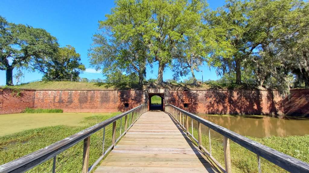
On the way back I stopped off at the ruined Fort Jackson, which I’d just happened to learn about recently watching an episode of “Abandoned Engineering”. I could just about see the even more ruined Fort St Peter on the opposite bank of the Mississippi, which together with Fort Jackson protected this absolutely vital waterway of the American hinterland throughout the 19th century. They were of particular strategic importance during the US Civil War, when the Union was able to power through the Confederates’ river blockade during two to three intense hours of bombardment from the twin forts, leading to one of the turning points of the War as the former gained a foothold into this hugely important region for the latter. My time in Fort Jackson was also completely void of anyone else, and the flies seemed pretty aggressive, so I didn’t stay long there either.
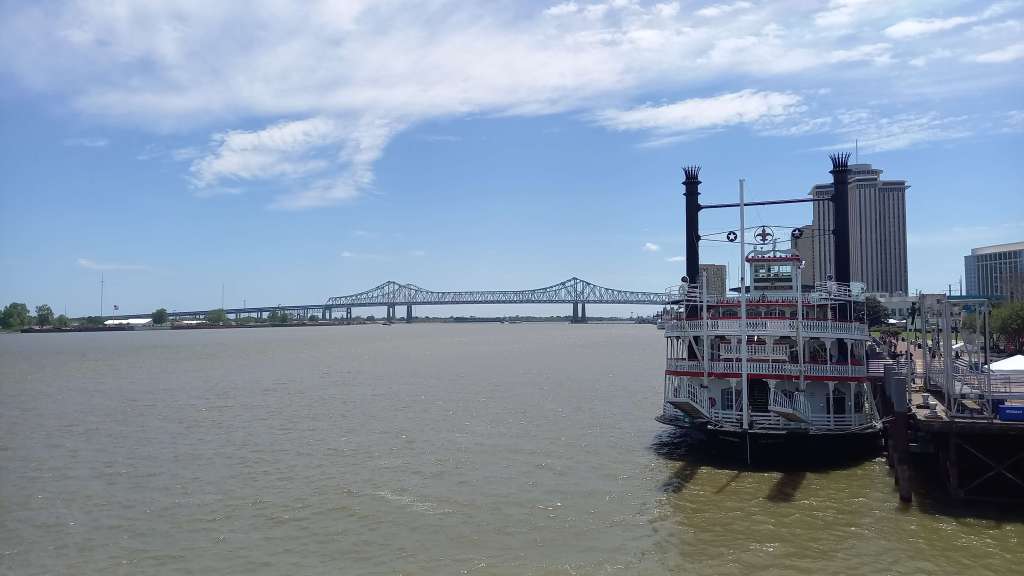
After driving back towards New Orleans again, I crossed back over the spectacular Mississippi River Bridge once more, this time over the other one. There are in fact two adjacent bridges side by side, one carrying four lanes of traffic, the other six, so together making for a total of ten lanes across America’s mightiest river at one of its widest points before it begins to split into the distributaries of its delta – it was quite a bridge! Did a supply stop at a local Walmart’s near to my motel, before checking in there for my two nights in “Norrlins”. While the motel itself felt fairly safe, it certainly felt a dodgy part of the city – on my second day there, a man was shot dead in his car not too far away after being caught in the crossfire of a shootout between two other vehicles.
Still, it was cheap and fairly cheerful, with a good breakfast and a laundry room to do my mid-trip washing. I was excited to explore the city proper the next day.
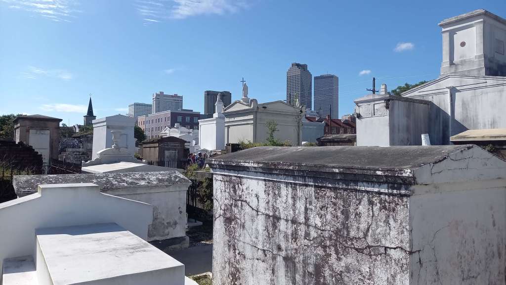
I had an amazing full day exploring the Crescent City, so-called due to the shape of the Mississippi River as it passes through the centre of town on its way to the sea. I started off with a tour of fascinating St Louis Cemetery Number One, the oldest and most famous of three cemeteries bearing that name on the outskirts of the city’s French Quarter. Since 2015, visits there have only been possible through guided tours due to the significance of the place and vandalism, and it was a fascinating and very informative tour by a delightful tour guide who I had the pleasure of speaking with at the end as we made our way back to the Visitor Centre.
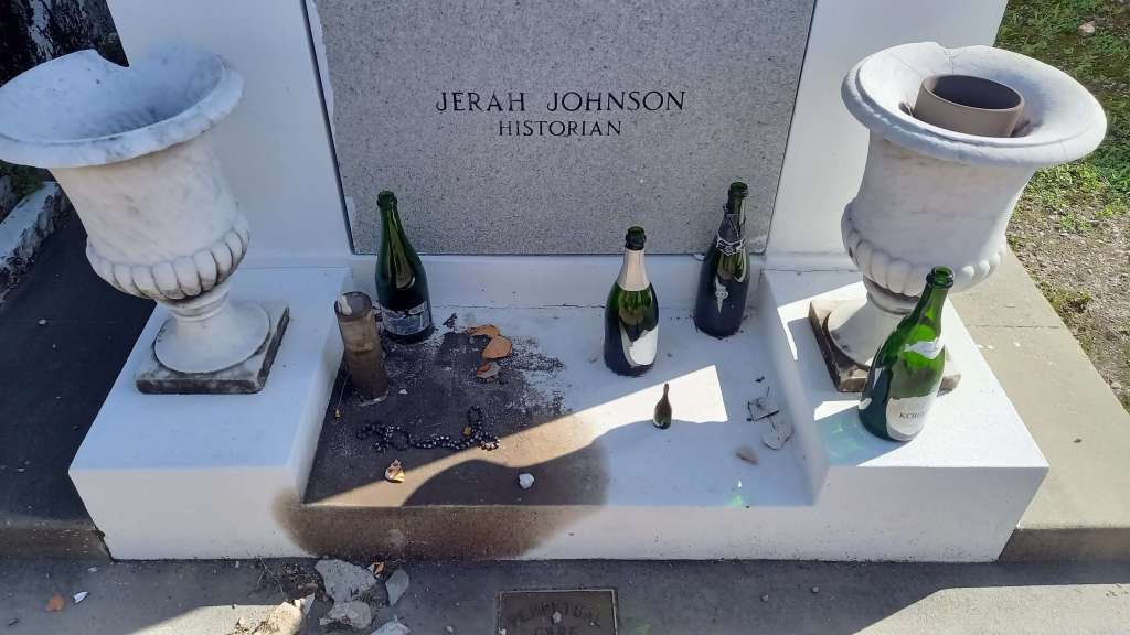
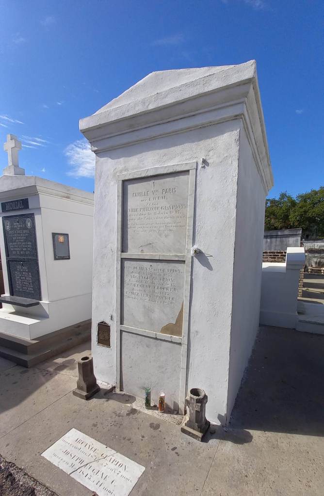
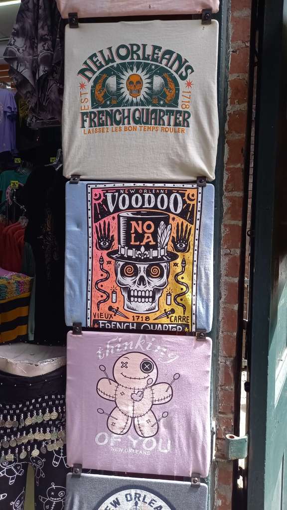
The most notable thing about New Orleans cemeteries is the fact that burials are made above ground, as with trial and error back in the first settler days of the 18th century they found out that the city’s high water table and regular flooding made underground burials impractical. They are also famous for being the last resting places of a number of voodoo figures, including Voodoo Queen Marie Laveau and Homer Plessy, both buried here in Number One. I am absolutely no fan of voodoo, though I did find interesting the voodoo doll offerings on some of the tombs even with pins stuck in them, along with the Triple X etchings denoting favours requested of the deceased by visitors. While New Orleans is indeed famous for being both a historical and current centre for voodoo practice, I was absolutely not interested in learning about this belief system during my time there. I still found the tour fascinating, and as mentioned the tour guide was a delight – she even had a family connection to the afore-mentioned Marie Laveau, who had introduced her grandparents, and had once baby sat her father as a child, who was 74 when she was born.
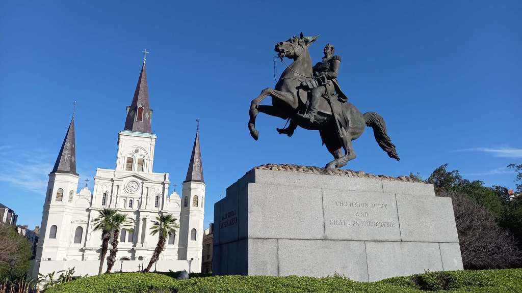
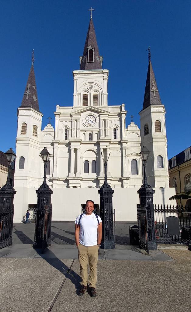
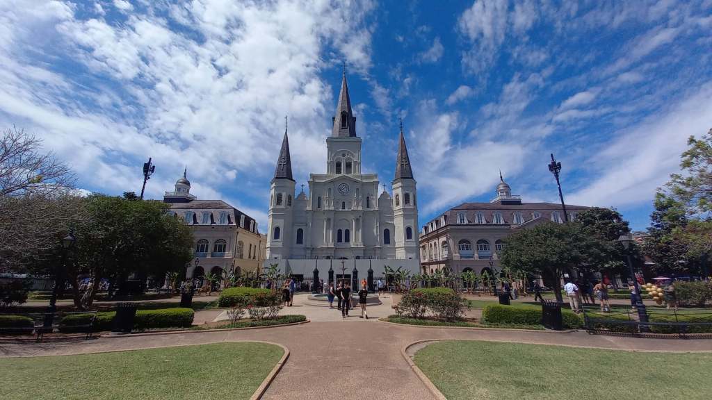
I then took a short initial walk through the city’s legendary French Quarter, stopping by at its iconic triple-towered mid-19th century St Louis Cathedral presiding over Jackson Square and its famous statue of Major General (later President) Andrew Jackson on horseback. I had done the earliest tour of the day at the St Louis Cemetery, and by this time it was still only 10am when most of the French Quarter was still waking up, after what had probably been yet another boozy night for the place. Jet-powered water hoses were doing their bit to clean down the streets, which I’d heard became pretty dirty each evening, I’d rather not think of what with. I pretty much had the square and the front of the church to myself – not so later when I returned to explore the French Quarter a bit deeper, more on that below.
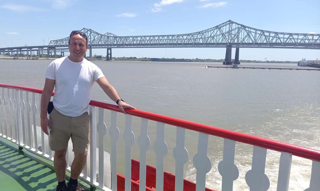
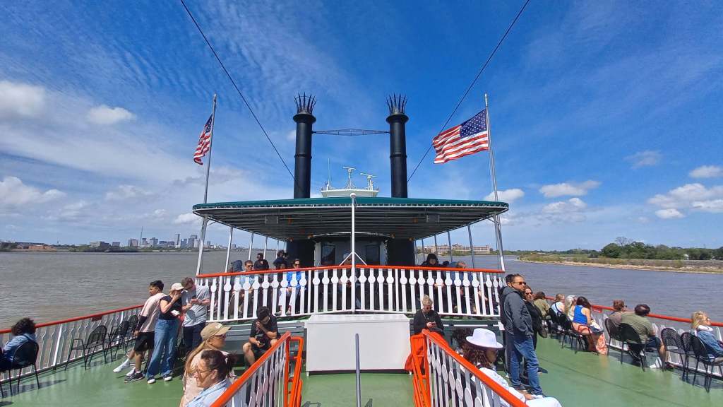
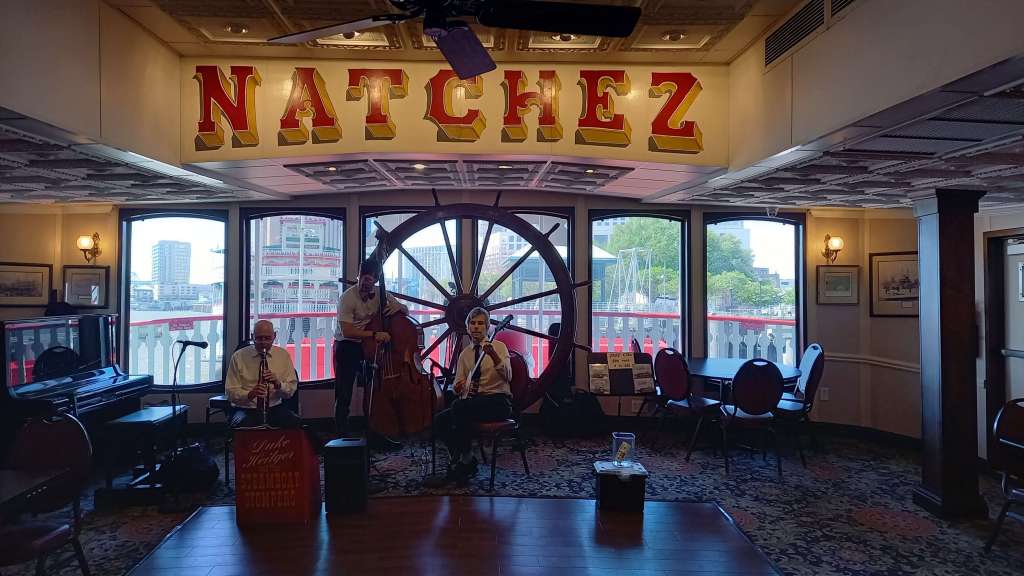
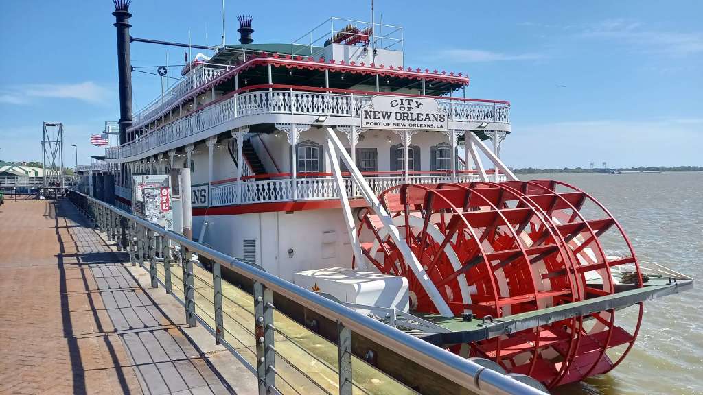
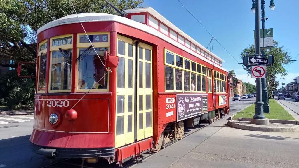
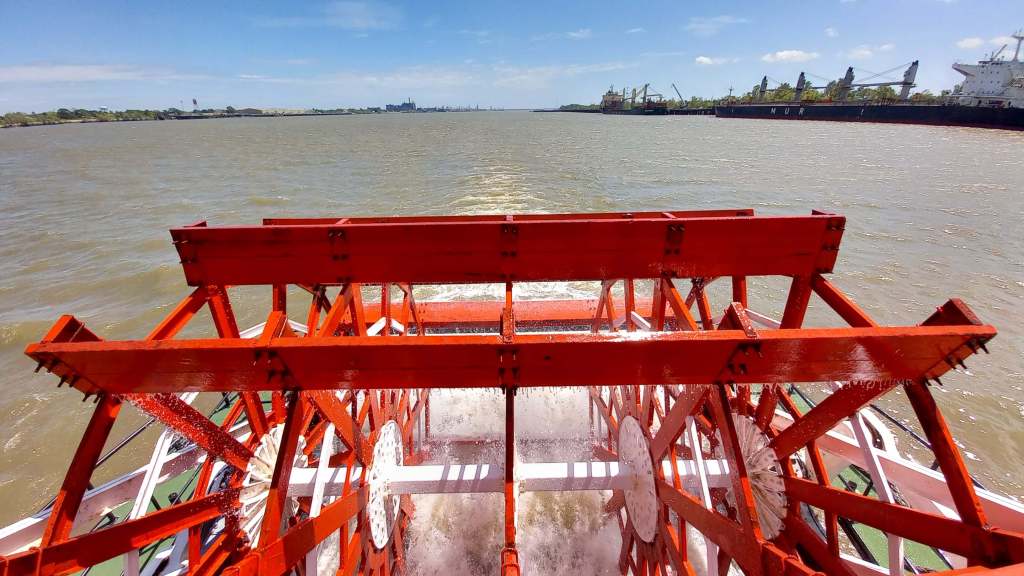
For now, I was on my way to my next port-of-call for the day – an 11am river cruise on a Mississippi River Paddleboat Steamer setting off from a nearby jetty. I loved this! Not only was the Steamboat Natchez an authentic 1975-built steam-powered “big wheel keep on turnin’” river vessel, the cruise also gave great views of the city from the river, with live commentary on the surrounding sights and a live jazz band for entertainment to boot. I really enjoyed the two-and-a-half hour jaunt on this most famous of rivers.
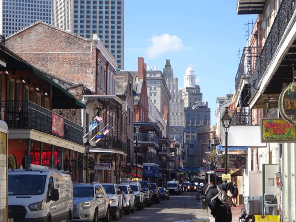
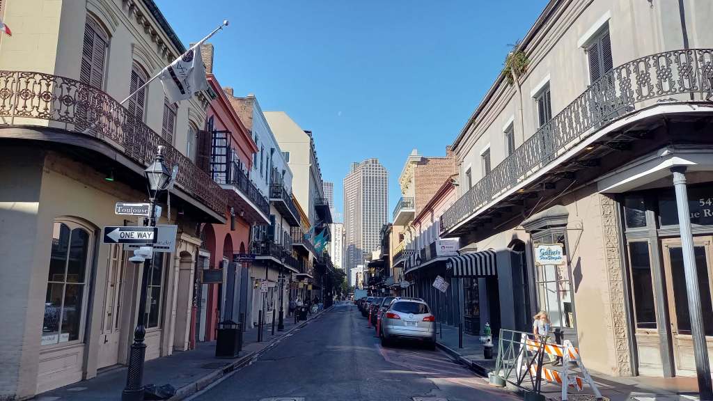
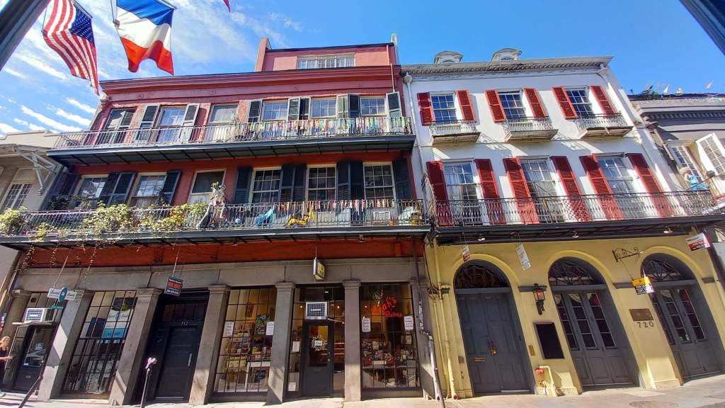
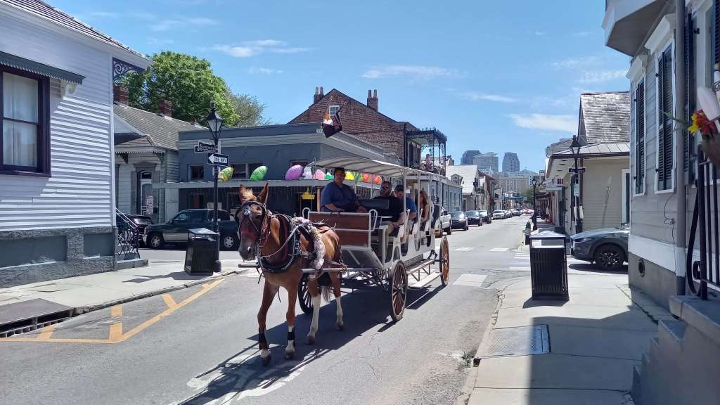
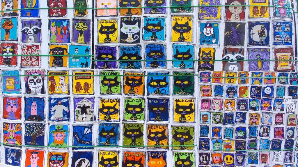
Next up was a couple of hours exploring the afore-mentioned French Quarter, built originally in 1718 after the French had claimed and settled Louisiana in 1682, naming it as mentioned earlier after the French king at the time, King Louis XIV. The current buildings actually date back to the late 18th century after France had ceded the territory to Spain in 1762, and are thus in fact Spanish in origin after fires had destroyed the original buildings in 1788 and 1794. In actual fact though, Spain gave the territory back to France shortly after in 1800, interestingly on the explicit proviso that they were not to hand any of it over to the Americans so as to maintain a healthy distance between them and their American continental rivals, after which and as mentioned they quite surprisingly sold it to the Americans three years later. What remains is a highly eclectic area absolutely unique in the United States, with low-rise two- to three-storey buildings fronted by wrought-iron balconies, and a vibrant atmosphere today filled with bars, cafes, restaurants, shops and lots and lots of music.
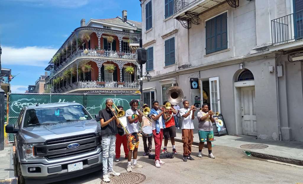
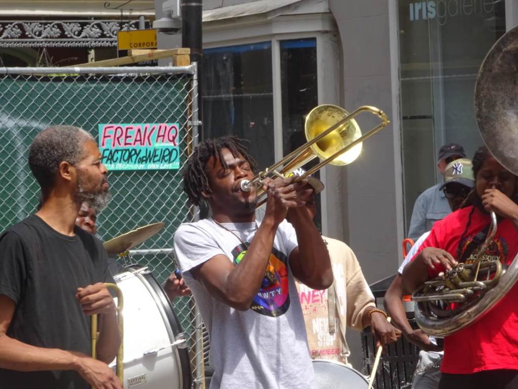
Having walked through the streets earlier that morning they were really quite quiet then, but now the people had woken up, tourists were thronging the streets, shops were filled with people, and music was seriously in the air. During my short time there I’d happened upon two separate street jazz bands with lively trumpeters and brass band players, and lots of happy people. I imagine the atmosphere intensified greatly in the evenings, though since that wasn’t really my scene I was happy to view it in the daylight. I can’t imagine what Mardi Gras must be like in the city, that certainly wouldn’t be my thing either.
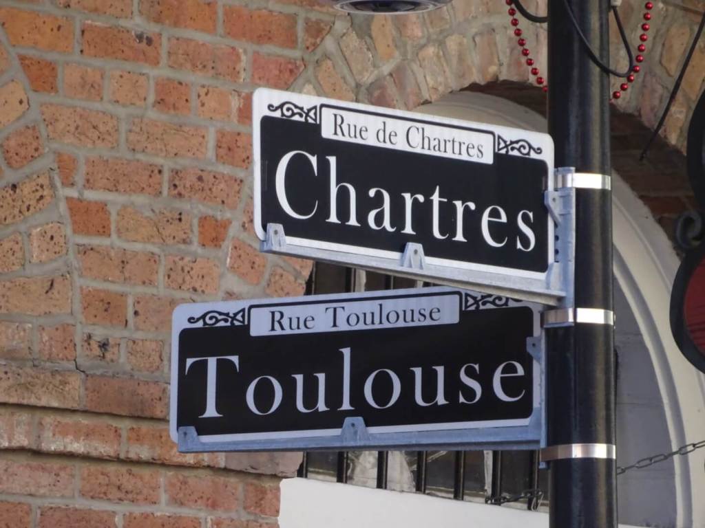
I took in the interior of St Louis Cathedral and really appreciated some prayer time there, Bourbon, Royal and Decatur Streets, and a statue of New Orleans native and quite possibly its most famous resident, Louis Armstrong in Louis Armstrong Park.
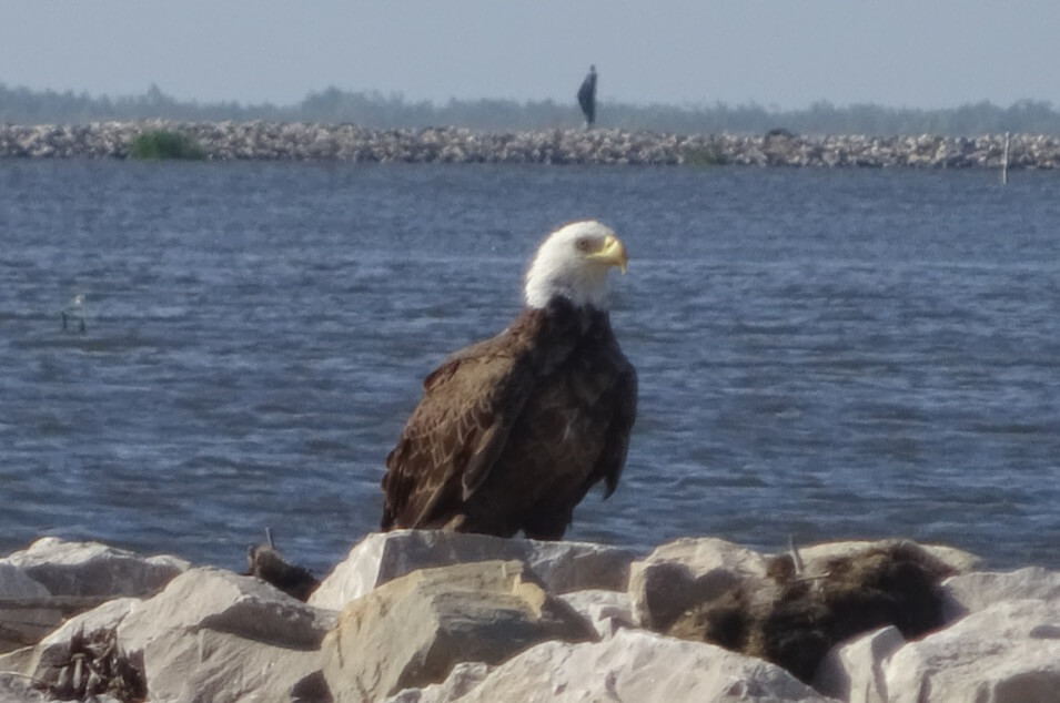
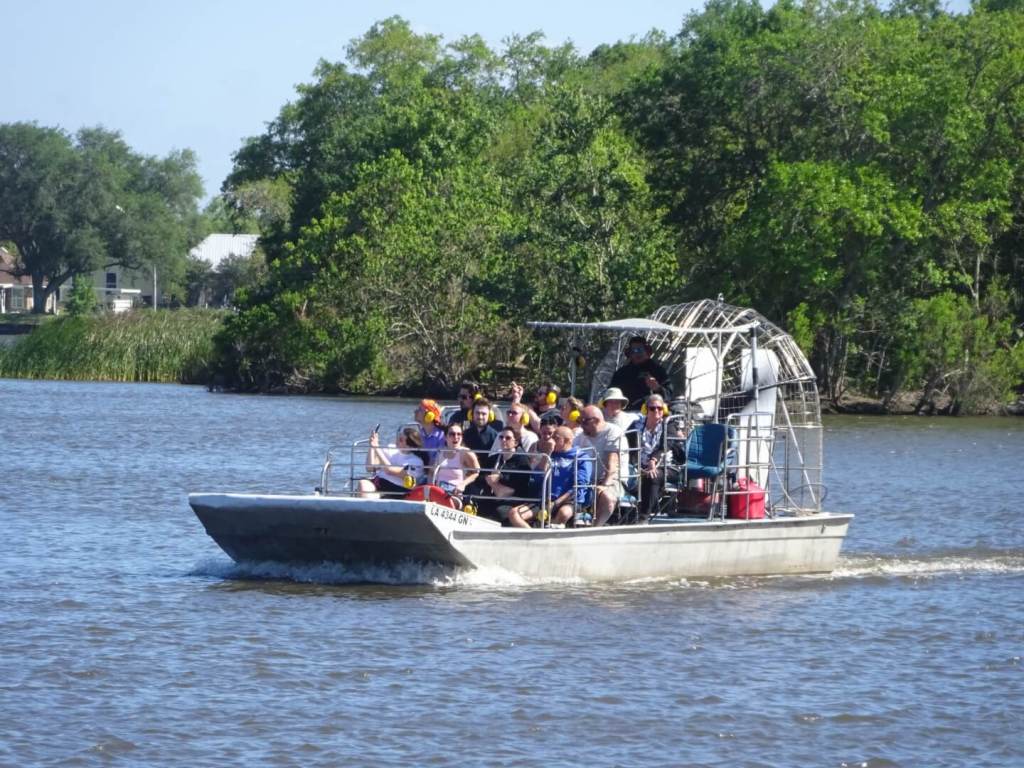
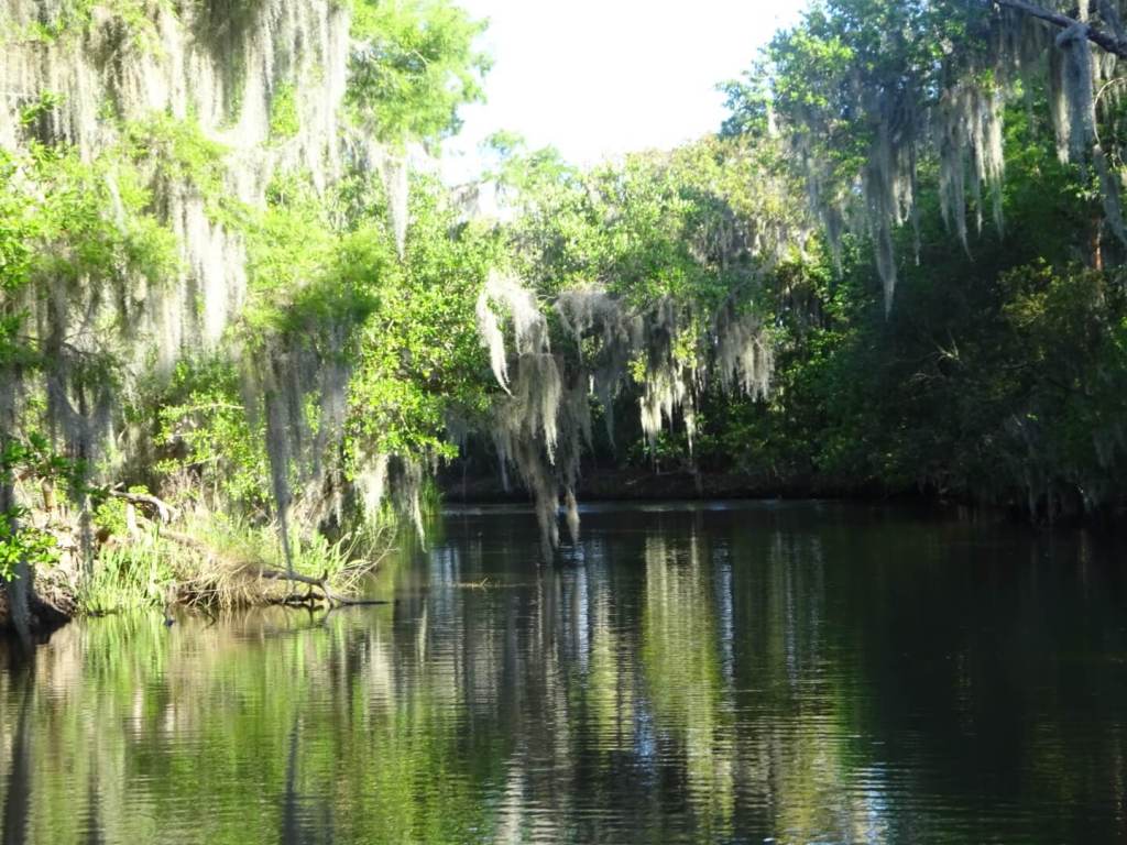
My final visit for the day involved a drive around an hour to the south of town, and into the Jean Lafitte National Historical Park and Preserve. Indeed, the city of NOLA (New Orleans, Louisiana) is pretty much surrounded on all sides by swamplands and marshes, known in these parts as “The Bayou”, a name derived from the local American Indian Choctaw people’s language and not in fact French as I had once thought. I was going for the last airboat swamp tour of the day, and loved my time on this most iconic of water vessels found both here in the Southland and also in Florida. They are perfect for riding these plant-filled waters as the motor and blade is on the back of the boat and not in the water, so that they don’t disturb the vegetation and wildlife as they take visitors across the watery landscape. Along with spotting plenty of alligators, I also had my first sighting of America’s most iconic bird, the bald eagle! After having also seen my first black bears in America a few days earlier, I was just stoked!
I headed back to my motel that evening, driving over the spectacular Mississippi River Bridge for my fourth and final time, a seriously happy man, and had thoroughly enjoyed my time exploring New Orleans and around. After an evening in with a whisky and a butter chicken ready meal, I was excited to be heading deeper into Louisiana, into Cajun Country nearby, the next day. More on that in my next.
